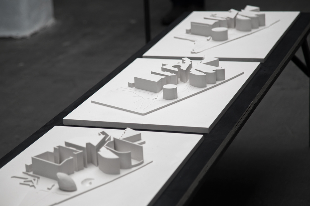
The architecture of the privately owned public space, "More London" on the south bank of the Thames, is forensically investigated through contrasting cartographic representations of the site.
The first is an objective topology collected by Ordnance Survey. The second is extrapolated from a site map provided by morelondon.com. The third, an aggregation of data gathered through first hand surveying in compliance with the stringent public order rules of the site.
In comparing the three models the varying perceptions of space are diagrammatised, centring critique around data and land ownership, the politics of the built environment and designed methodologies for experiential mapping.
Project created by Tom Wagstaff with support from Subject.